
Fascinating destinations, thrilling adventures, amazing scenary, cultural highlights, food, drink and much, much more… Plan your Lakeland adventure here!


Our Cragg House Farm Experience Activities
Sometimes you don’t even need to leave the farm to have an unforgettable Lake District experience…
-

Lake District Shepherd Experience
Have you ever been in awe, watching a shepherd use their dog to move flocks of sheep and wished you could do that? Here at Cragg House Farm, you can have the most magical Shepherd experience with our talented team of dogs on a traditional hill farm set in one of the most stunning valleys in the Lake District, Buttermere.
-

Rare Breed Goat Picnic
Are you looking for a unique outdoor eating experience? Here at Cragg House Farm, you can have the most picturesque picnic experience on a traditional hill farm set in one of the most stunning valleys in the Lake District, Buttermere.
-

Rare Breed Pig Cuddles
Come for a walk with us to feed the pigs and enjoy some hands on cuddles with these wonderful animals - at certain times of the year we may have piglet cuddles too!
-

Sheep Trekking
Join us for an adventure with a difference!
Get to know our friendly, halter-trained, pedigree sheep before taking them for a walk up the fell to see where the rest of the flock lives.
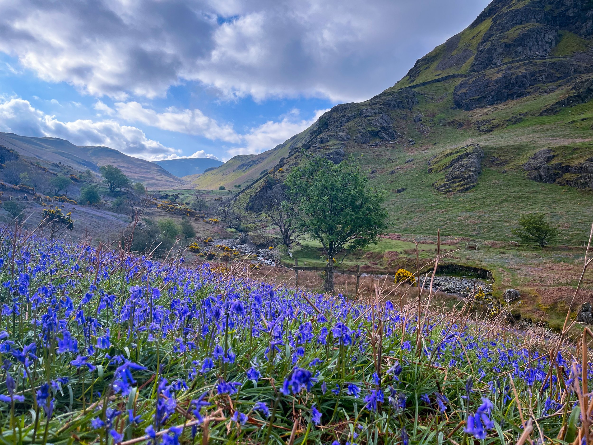
Our Favourite Walks
These are some of our favourite local walks. The route map link will take you to the OS mapping site - if you are a subscriber you will receive all your membership benefits (detailed map & 3D aerial map visualisation), if you are a non-subscriber you can view a base map.
-

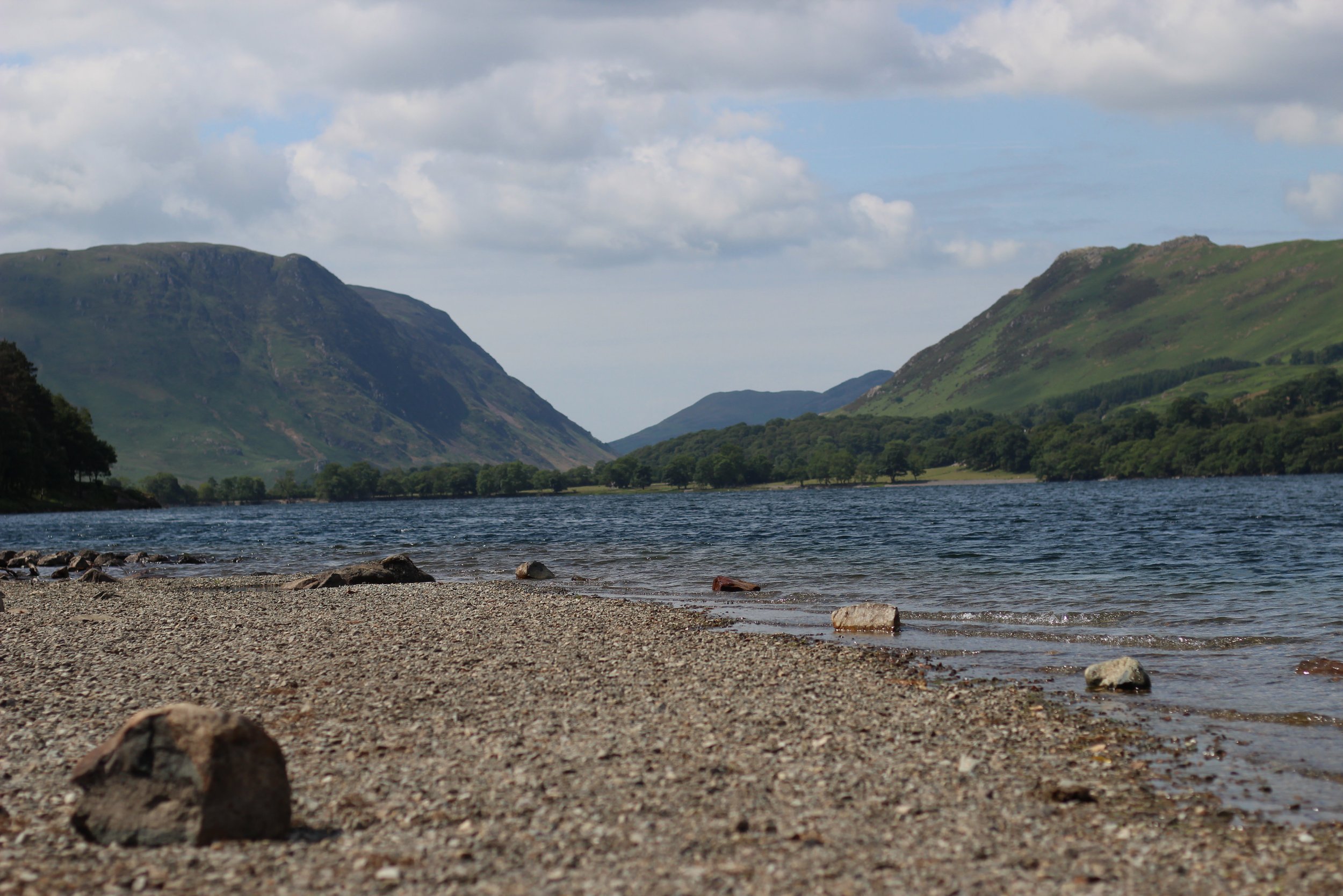
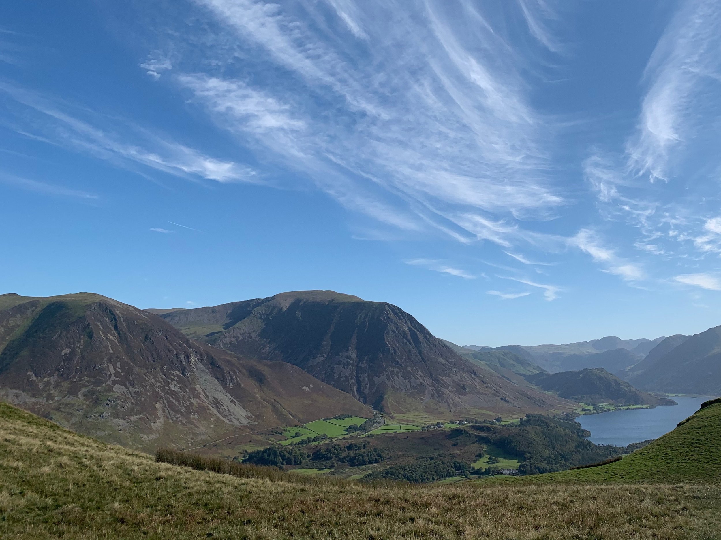
Buttermere Lakeshore
A lovely walk with panormaic views of the valley from all angles - best of all it starts from the farm yard so you can walk from the door.
Distance: 7.2km
Ascent: 102m
-

Scale Force Waterfall
A lovely walk that starts from the farm yard and visits the highest waterfall in the Lake District! It has a single drop of 170ft and then two more 20ft drops.
Distance: 8.9km
Ascent: 176m
-

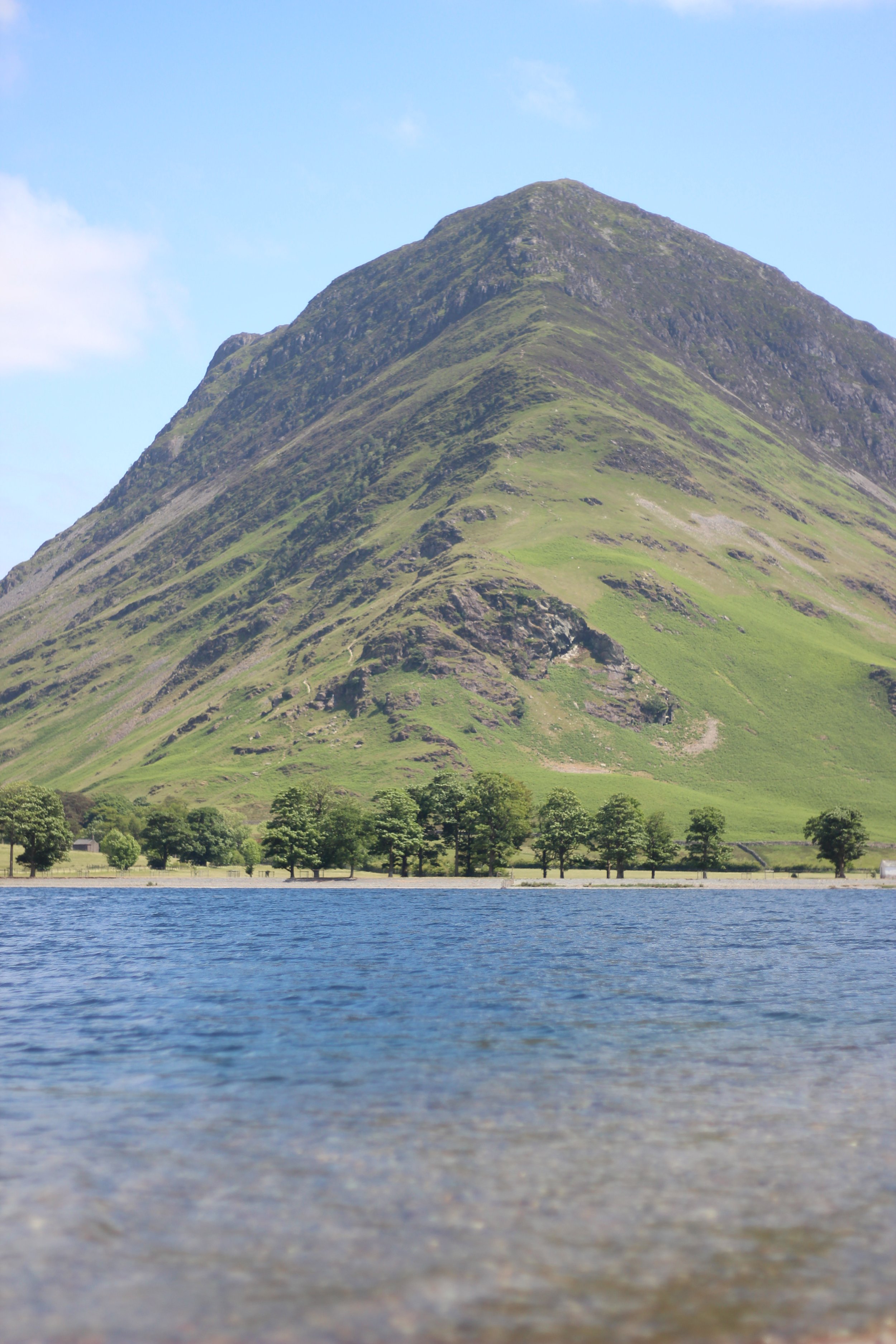
Crummock Water Lakeshore
What makes this walk special is that you get to discover quiet corners of this popular hotspot whilst being surrounded by panoramic views - the bonus is you can walk from the door!
Distance: 12.3km
Ascent: 238m
-

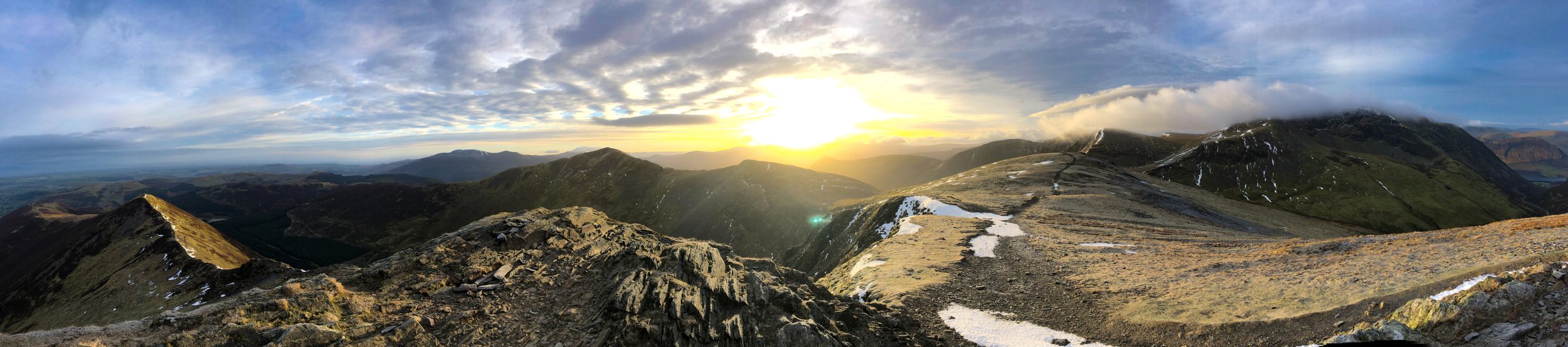
High Stile Range
A challenging route that takes in the summits of Red Pike, High Stile & High Crag that is best enjoyed in good weather - it's worth the early alarm call to watch the sunrise from the summit of Red Pike.
Distance: 12.5km
Ascent: 925m
-
Rannerdale Knotts
What Rannerdale Knotts lacks in height (Rannerdale Knotts is one of the smallest lakeland fells) it more than makes up for in its mountainous character and beautiful views - it's another walk from the door of Cragg House Farm!
Distance: 4.3km
Ascent: 295m
-
Fleetwith Pike
Start this walk from the car park at Gatesgarth Farm - get there early to increase your chances of finding a space. The summit gives superb views over Buttermere and up to the Lorton Vale.
Distance: 5.7km
Ascent: 560m
-
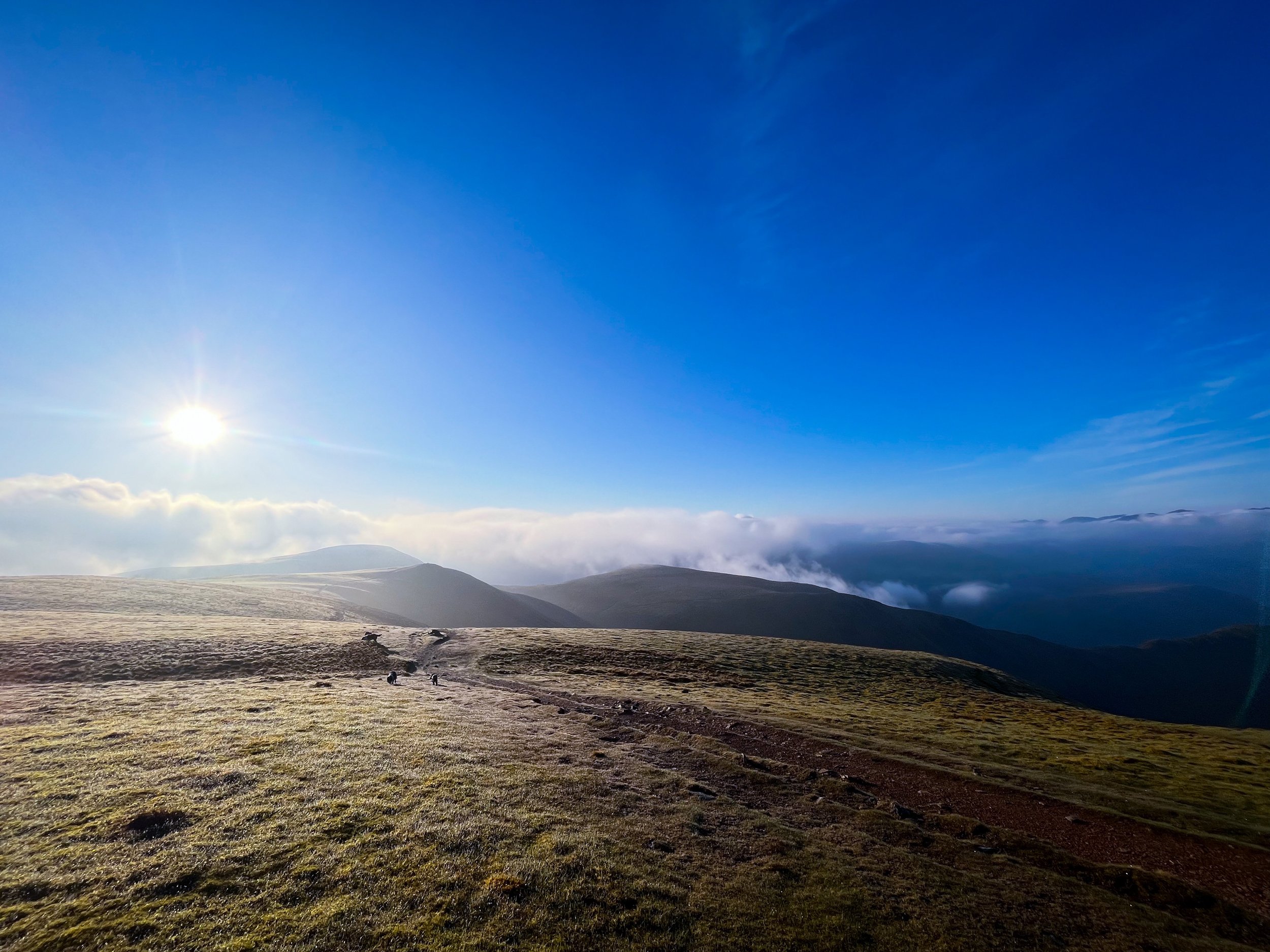
Grasmoor, Wandope & Whiteless Pike
A lovely walk that you can start from the farmyard or if you want to catch the sunrise from the top (highly recommend) park at Cinderdale Common & start immediately with the ascent of Grasmoor.
Distance: 11.2km
Ascent: 981m
-

Lord's Seat, Broom & Barf
A lovely walk that starts a short drive from the farm yard and takes in 3 Wainright summits. Parking at Whinlatter means you can refuel at the onsite cafe after the walk.
Distance: 11.5km
Ascent 496m
-

Knott Rigg & Ard Crags
This route starts at the top of Newlands Pass which you can drive to. It is an out and back walk that ticks off two Wainrights and has spectatcular views everywhere you look!
Distance: 2.7km
Ascent: 270m
-
Whiteside & Hopegill Head
Start this walk just along the road at the Lanthwaite Green parking area - or if you are feeling adventurous you can walk there from the farm. This walk serves dramatic views - especially at sunrise & sunset.
Distance: 8.1km
Ascent: 694m
-

Robinson & Hindscarth
If you want to get to the top of Robinson quickly you can park at the top of Newlands Pass and do a quick out and back walk or if you want to fully marvel at that beauty of our local area we recommend this route that also takes in Hindscarth.
Distance: 11.7km
Ascent: 802m
-

Brackenthwaite Hows
A lovely, circular walk that offers spectacular views and starts just a short drive from the farm at Lanthwaite Green. You pass so close to the shores of Crummock that it makes sense to add it into the route.
Distance: 5.4km
Ascent: 232m
-

Mellbreak
Parking for this route is at the National Trust car park at Scale Hill at the top of Crummock Water. Not only do you get to tick off a Wainright you then get a lovely stroll back along the lake shore passing through some of our grazing at High Park as you approach the end of your walk.
Distance: 11.1km
Ascent: 546m
-

Loweswater Terrace
This walk packs in a variety of scenary from mountainous views to ancient woodlands and lakeshores. There is limited parking here so try to aim for quieter times or ask us and we can show you alternative options for parking so that you can still enjoy this brilliant walk.
Distance: 8.7km
Ascent: 250m
-
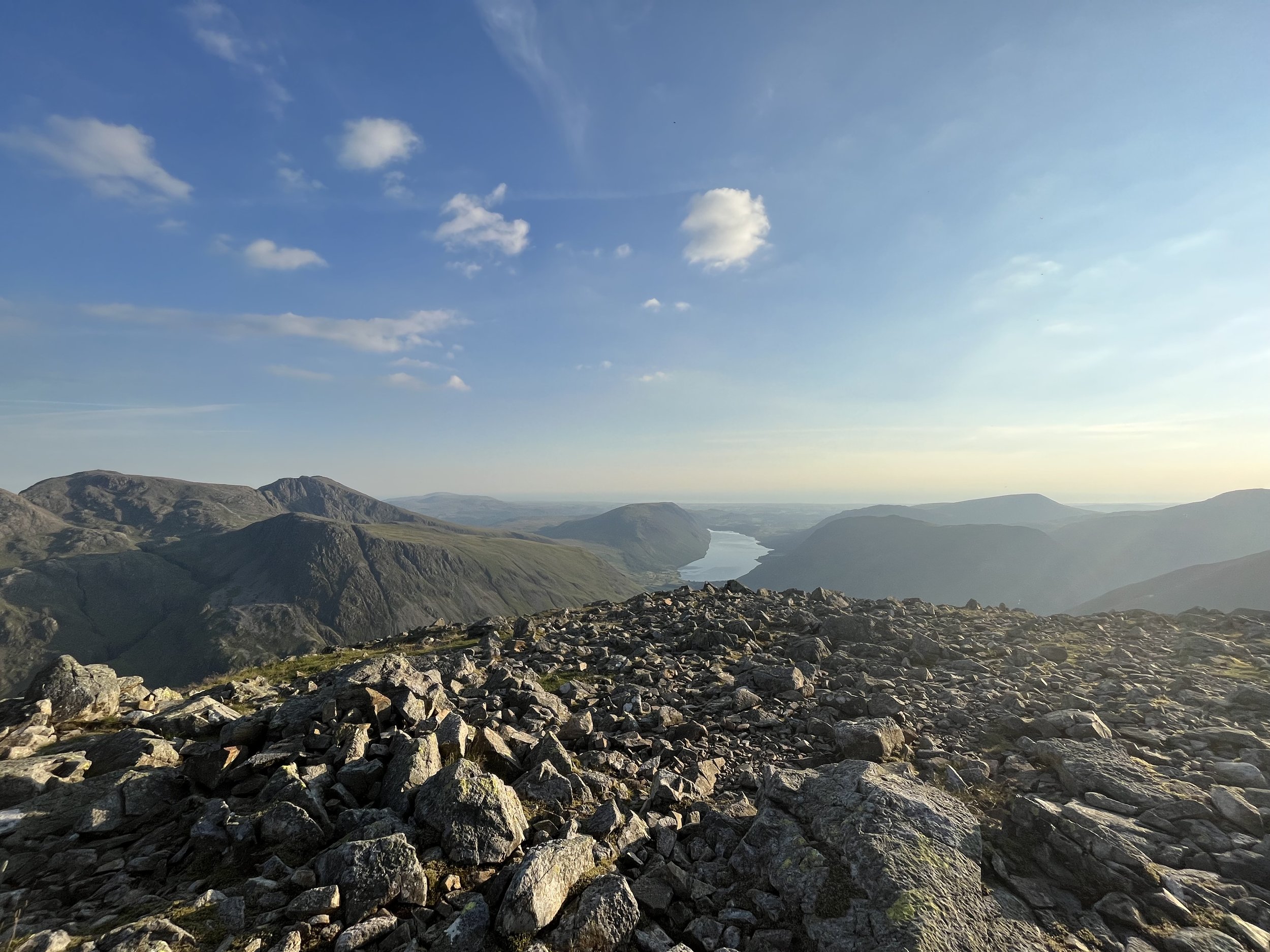
Great Gable & Green Gable
This walk starts just up the road at Honister Slate Mine and also takes in the summits of Grey Knotts & Brandreth. We particularly love this walk at sunset as the views are breathtaking watching the sun setting and reflecting in the sea.
Distance: 9.25km
Ascent: 736m
-
Ennerdale Lakeshore
The Ennerdale landscape is gradually being rewilded by the Wild Ennerdale Partnership and can be a quiet place to explore even during the height of the season. It is just a short drive from the farm round to the neighbouring valley.
Distance: 18.4km
Ascent: 179m
-
Low Fell & Fellbarrow
This route starts just up the road from the farm with limited off road parking in Thackthwaite - please remember to park with care and you will be rewarded with postcard worthy views from the summit of Low Fell.
Distance: 6.5km
Acsent: 490m
-

Dale Head
This route starts at the parking at Chapel Birdge on the outskirts of Little Town - get there early (or later if you are wanting to catch the sunset) to get a space. You are rewarded for your effort on this walk and we can recommend timing your summit of High Spy with sunset.
Distance: 12.2km
Ascent: 830m
-

Grisedale Pike Circular
This big walk takes in 6 different Wainright summits (Grisedale Pike, Crag Hill, Sail, Scar Crags, Causey Pike & Barrow) in a circular route that is fairly straightforward to navigate (on a clear day) as you can almost see your entire route from every part of the route. Parking is a little layby at the start of Whinlatter Pass.
Distance: 16km
Ascent: 1250m
-

Castle Crag
This walk starts at the National Trust car park in Seatoller just over Honister Pass. This route takes you on one of the most scenic approaches to Castle Cragg (the smallest Wainright). The ascent to the summit is short and sharp but worth it.
Distance: 7.1km
Ascent: 330m
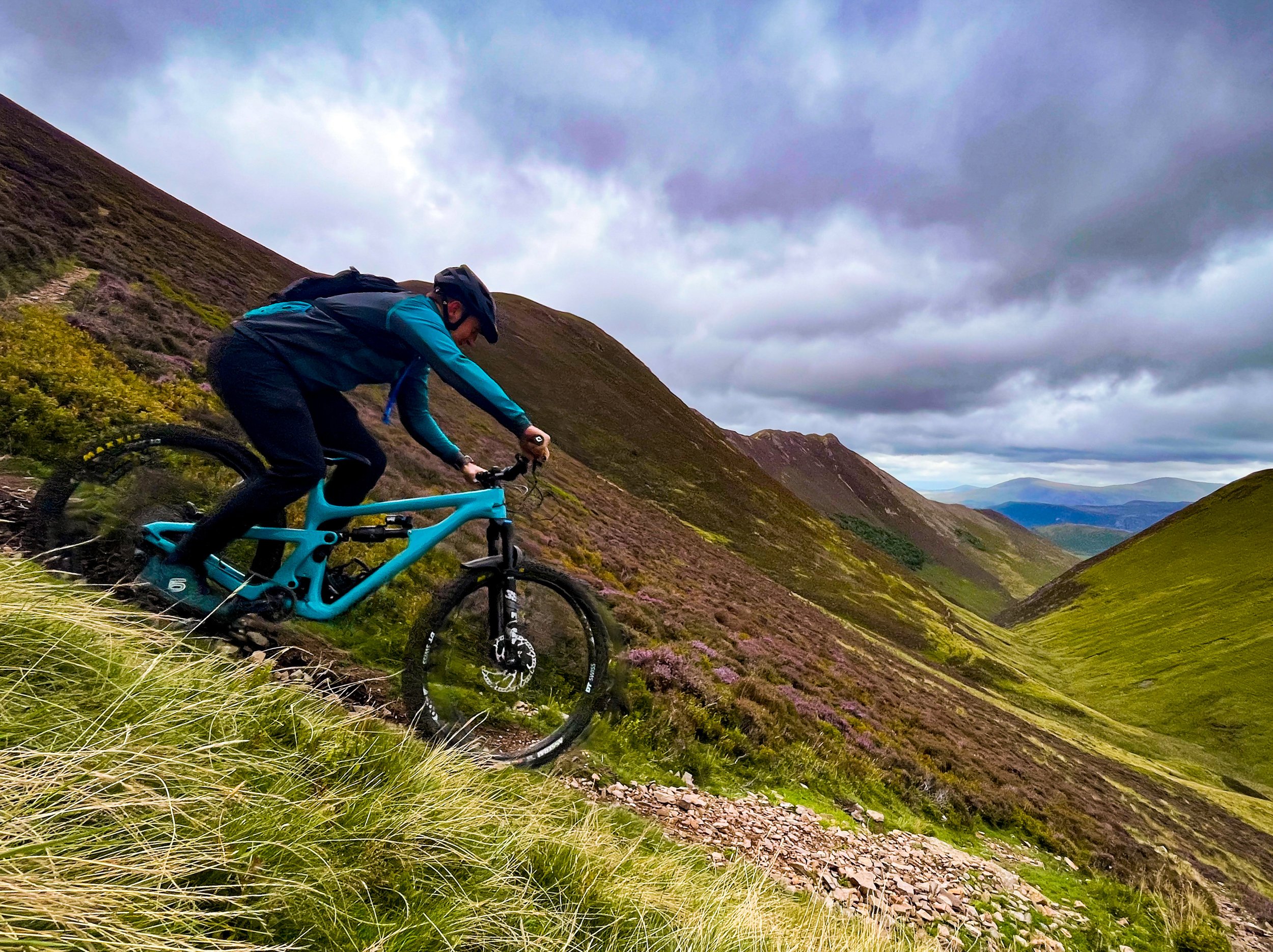
Our Favourite Bike Rides
These are some of our favourite bike rides. There are many more routes on our doorstep that cater for families, gravel and road bikes so please ask if you are looking for something in particular. The route map link leads you to the OS mapping site - if you are a subscriber you will receive all your membership benefits (detailed map & 3D aerial map visualisation), if you are a non-subscriber you can view a base map.
-

The Borrowdale Bash
A lakeland classic mountain bike route that only requires a little bit of pushing on some of the climbs. Its a big ride with views of Watendlath, Honister and Castle Crag.
Distance: 30km
Ascent: 930m
-

Lonscale Loop
A short but sweet loop that starts from Keswick and packs in breathtaking views and dreamy singletrack.
Distance: 18km
Ascent: 500m
-

Loweswater Terrace
This ride packs in a variety of scenary from mountainous views to ancient woodlands and lakeshores. There is limited parking here so try to aim for quieter times or ask us and we can show you alternative options for parking so that you can still enjoy this brilliant ride.
Distance: 8.7km
Ascent: 250m
-

Whinlatter Forest
A lovely set of waymarked trails that start a short drive from the farm yard and are a great introduction to riding in the Lake District.
Blue - Quercus Trail: 7.5km
Red - North Loop: 10km
Red - South Loop: 9km
-

Cyclewise
Bike hire, repairs and shop based in Whinlatter forest.
Visit Website -

Whinlatter Bike Shop
Based in Keswick - provides hire, repair and a shop!
Visit Website -

E-Venture Bikes
E-Bike hire from Keswick
Visit Website -

Bike Treks
Bike shop in Keswick
Visit Website
Unearth
-

Hardknott Roman Fort
Ravenglass & Eskdale
-

Muncaster Castle
Ravenglass & Eskdale
-

Castlerigg Stone Circle
Keswick
-

Derwent Pencil Museum
Keswick
Inquire
-
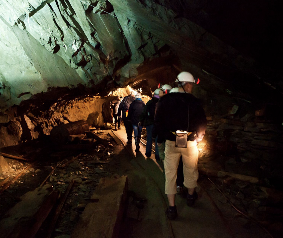
Honister Slate Mine
Honister
-

Lake District Coast Aquarium
Maryport
-

The Puzzling Place
Keswick
-

Lakes Escapes
Workington
-

Theatre by the Lake
Keswick
-
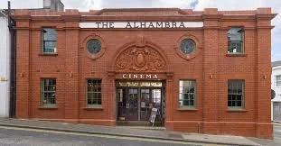
Keswick Alhambra Cinema
Keswick
-
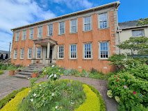
Wordsworth House & Garden
Cockermouth
-

Kong Adventure Climbing Wall
Keswick
Visit Website
Conserve
-

National Trust
Various Locations
-

English Heritage
Various Locations
-

Fix The Fells
Various Locations
-

Cumbria Wildlife Trust
Various Locations
Champion
-

The Bridge Hotel
Buttermere
-
Syke Farm Tearoom
Buttermere
-

Buttermere Court Hotel
Buttermere
-

Croft House Farm Cafe
Buttermere
-

Kirkstile Inn
Loweswater
-

The Wheatsheaf Inn
Lorton
-

Embleton Spa Hotel
Embleton
-
Coledale Inn
Braithwaite
-

The Royal Oak
Braithwaite
-
Lyzzick Hall Hotel
Near Keswick
-
BLOCKS Steakhouse
Cockermouth
Visit Website -

The Lakes Distillery
Near Cockermouth
-

Grasmere Gingerbread Shop
Grasmere
